Time is running out and I've been planning on taking Gary up Picacho Peak. There is a civil war re-enactment there this weekend so we can group them together. Picacho peak is about 50 miles north of Tucson. Glad we're not going the other way, I guess Trump decided to come to Tucson - I see a lot of people who won't be voting for him! Traffic is stopped for miles in the other direction

We get here,
The Hunter Trail to the Peak is 3 miles round trip with an elevation gain of 1,780 feet.
Looks like a lot of other people had the same idea, we'll have a short hike to the trailhead.

We get here,
The Hunter Trail to the Peak is 3 miles round trip with an elevation gain of 1,780 feet.
Looks like a lot of other people had the same idea, we'll have a short hike to the trailhead.
Let the games begin. I had hoped to get here by 8 a.m. but it's shortly after 9 now and it's supposed to get into the upper 80's. We'll do the best we can.
The first of many handrails and cables to help you along.
Which way do we go?
Guess we turn right here.
It's a bit of a scramble in places but Gary is doing great even
though he isn't a Capricorn like me!
The Saddle is just ahead.
The view is great
We made it to the Saddle. Now we go back down the south side of the Mountain before going back up again to the peak.
A 40 ft light beacon was built on the top to help air traffic navigation. Hunter trail on the south side of the peak built by the CCC to facilitate servicing the beacon which was removed in 1965. The trail on the north side to the Saddle was added in 1968 to connect to the South trail.The descent begins
Nice views on the other side as well
Back up we go
There are still quite a few people coming up behind us
The next set of cables. Glad we brought the recommended gloves.
Oh boy more cables
Taking a break and enjoying the view
It's hard to see the next set of cables. I think there are two on that next rise, one is very steep and then the ridge to the left leads you to the peak. I zoomed in to the one that leads to the ridge,

So close and yet so far but we remember that descent from the Saddle and that it becomes an ascent on the way back so we make the decision to turn around.
Next Stop - Civil War. Deluxe ride to the battle site.
Just as we arrive at the battle site, we hear the cannons and rifles. I thought - oh no - we just missed the battle, but some one says no - it has just started and directs us where to go
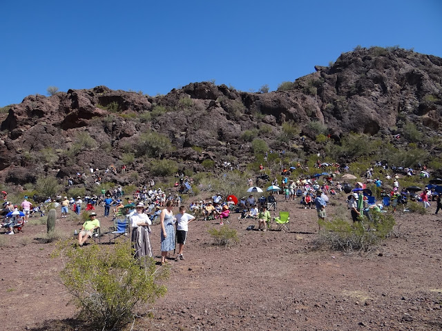
There's a good crowd in spite of the heat
In February 1862, Confederate Rangers lead by Capt. Hunter raised the Confederate flag over Tucson, Arizona, in an effort
to create an ocean-to-ocean Confederacy. In order to thwart this move, a
Union forces from California lead by Col. James H. Carleton set out
across the lonely desert toward Tucson. On April 15, Union cavalry
under Lt. James Barrett met with Confederate Rangers near Picacho Peak, Barrett was killed almost
immediately and a fierce battle continued for more than an hour
before the Federals retreated. Although the Rangers' victory at Picacho
Pass delayed the Union force, Carleton's
Californian's eventually took Tucson without firing a shot a month later.
It was one of the best re-enactments I've seen. I wonder how long wars would last today if it was still hand to hand combat instead of a push of a button from thousands of miles away?
It's hot so we leave and decide after almost making to the top of the local Mt. Everest - it's time for a Blizzard!
A Pecan Cluster Blizzard - yeah!
Tastes great after a good hike.
We follow a dirt devil on the way home!


No comments:
Post a Comment
Talk to us! Let us know what you think!