Memorial Day Weekend and trying to avoid the crowds, so we head down Hole in the Rock Road to hike up to the Dinosaur tracks.
 Lot's of people camping on the National Forest Land
 The road is a lot busier than the last time we were on it - and lots more washboard. It's a dusty ride with people screaming by.

Before long we come to our turn off.


We find the trailhead.
There are hundreds of dinosaur tracks
around 155 million years old.
 Tucson leads the way up

Hurry up you guys!
 Could these be dinosaur tracks? Nope.
 Gary brings up the rear
 I think I found something Mom! Not sure what this is.

Quite the view

Gary found one!

These round ones are from Sauropods - such as a Brontosaurus

This duck foot shaped one is from a Theropod - like a Tyrannosaurus Rex

 Tucson makes sure no dinosaurs sneak up on us


Before long we come to our turn off.

The Dinosaur tracks are about 2.5 miles down the road

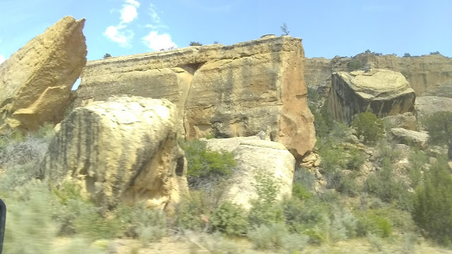
They are in the white sandstone cliffs ahead.

We find the trailhead.
There are hundreds of dinosaur tracks
around 155 million years old.


Quite the view

Gary found one!

These round ones are from Sauropods - such as a Brontosaurus

This duck foot shaped one is from a Theropod - like a Tyrannosaurus Rex


I found some more Mom!

This little guy would have been a Yorkie Pancake


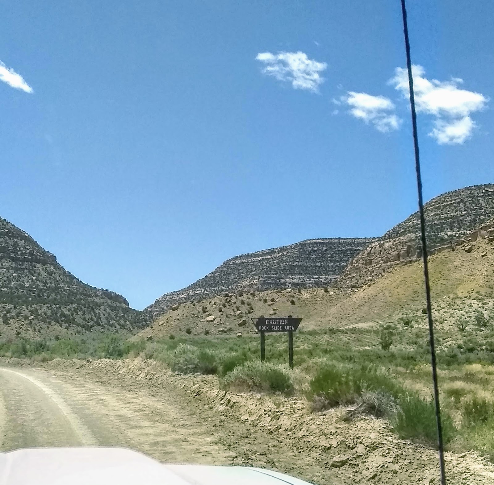
 Rock Slide area - that should make it interesting.

 The road isn't bad and the scenery is ruggedly beautiful

There's a pesky boulder in the road ahead.
 Then we start getting down into the Canyon
 Looks like we might hit a wall

But we make it through


 There are some big boulders around these parts!


Which way do we go? We head left as the right looks more like a wash.

Further up the road we run into our ATV friends coming back towards us. They say we missed our turn back a ways and the road is getting too narrow ahead for us to turn around.

We get turned around and go back to the turn they thought we missed and drive down it a short ways and it gets much worse than the road we are on and looks more like a wash to me. Looking at the Map they gave us, I say it looks as though we need to continue on the road we were on for another 10 miles or so. We say we are going to go back up the mountain and I don't recommend driving the wash. They agree and head up the mountain as well

You can barely make out the road we are on below us just left of center.
 We hope nobody comes from the other way
 I am beginning to wonder of we should have taken that other road.

 and we are relieved to see signs for our Turn to Escalante!
I did pick the right road!
 We run into our ATV friends coming back the other way - just in time or we might have missed the Indian Ruins


 Mommy can we move here?

We continue on and plan to hook up with our ATV friends by the Pictographs near the end of the loop. I thought we should turn at this point over to Smoky Mountain Road but we follow our ATV friends towards Escalante
 Smoky Mountain Road is another roller coaster ride


We catch up to our ATV friends who were delayed by a cow crossing.


68 Miles in 6 hours - it was hair raising at times - but glad we did it. The road was so rough at times that when I tried to take pictures the camera was jarred as I was pressing the button so some photo ops missed. My fitbit also gave me 4,000 extra steps!

This little guy would have been a Yorkie Pancake


There's no shady spot to have lunch so we head out. We had been on Smoky Mountain Road out of Escalante last week and saw you could do a 68 mile Loop drive to Left Hand Collett Canyon Rd to Hole in the Rock Road and back to Escalante. We've already driving 24 Miles here and it will be 24 miles back the way we came, so we decide to try it in reverse and make a Right Hand turn onto Left Hand Collette.

Not a place I would be setting up a tent.


There's a pesky boulder in the road ahead.


But we make it through

We find a shady spot to stop for lunch - Gary didn't pull over all the way to the left because we were afraid of soft dirt. Shortly thereafter a couple we met at Dinosaur Tracks came by with their ATV. We asked where they were headed as there is no cell service on this road and they say if you break down you should have a mirror to signal for help and lots of water and food for 3 days. We're good for the rest of the day. They are headed to Escalante as well and give us a couple maps that the ATV company gave them.


Which way do we go? We head left as the right looks more like a wash.

Further up the road we run into our ATV friends coming back towards us. They say we missed our turn back a ways and the road is getting too narrow ahead for us to turn around.

We get turned around and go back to the turn they thought we missed and drive down it a short ways and it gets much worse than the road we are on and looks more like a wash to me. Looking at the Map they gave us, I say it looks as though we need to continue on the road we were on for another 10 miles or so. We say we are going to go back up the mountain and I don't recommend driving the wash. They agree and head up the mountain as well

You can barely make out the road we are on below us just left of center.


and it looks like the end of the earth ahead.

I did pick the right road!


We continue on and plan to hook up with our ATV friends by the Pictographs near the end of the loop. I thought we should turn at this point over to Smoky Mountain Road but we follow our ATV friends towards Escalante


We catch up to our ATV friends who were delayed by a cow crossing.


We make it back to Escalante but miss the Pictographs. Our friends ATV had to be returned by 4 pm. and it is just after 4 pm.
68 Miles in 6 hours - it was hair raising at times - but glad we did it. The road was so rough at times that when I tried to take pictures the camera was jarred as I was pressing the button so some photo ops missed. My fitbit also gave me 4,000 extra steps!
No comments:
Post a Comment
Talk to us! Let us know what you think!